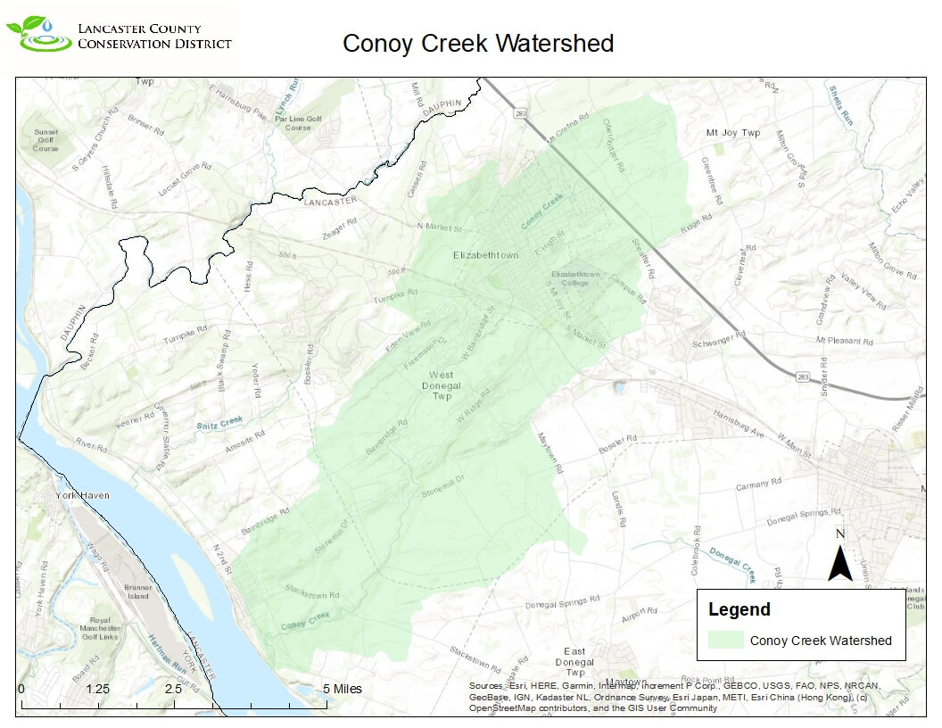
Conoy Creek
No current Associations
All individuals interested in forming an Association to monitor the Conoy Creek are encouraged to contact Lancaster Watersheds by emailing MattKofroth@lancasterconservation.org
Downstream Flow: VIEW GOOGLE MAP
Conoy Creek » Susquehanna River » Chesapeake Bay
Contributing Municipalities
Conoy Township, Elizabethtown Borough, Mt Joy Township and West Donegal Township
Monitoring Data
Volunteer Monitoring Data Microsoft Excel Online
Sampling Sites: 4, 5, & 8
The Conoy Creek Watershed is located in the Northwest corner of the county. This 19 square mile watershed was originally named for the Algonkian tribe related to the Naticoke and Delaware Native Americans who moved to the Susquehanna River Basin from the Potomac River Basin in 1704. Today there are about 30 miles of streams in the Conoy Creek Watershed. The mainstem starts northeast of Elizabethtown and then flows southwest to its confluence with the Susquehanna River around Bainbridge. According to the USGS Stream Stats website only 12% of the watershed is forested and about 13% of the watershed has urban development in it. The watershed starts and goes through the town of Elizabethtown but does not really go through any other larger towns or cities. Presently there is not an active watershed association working within the Conoy but there was a small group in the past doing some conservation work within the watershed. This organization mostly dealt with education and outreach around the Elizabethtown area. There have been limited watershed surveys conducted on the Conoy over the years but the watershed has been part of previous studies around surrounding areas.


