Donegal Creek
Donegal Creek Fish & Conservation Association
No recurring meetings
donegalcreek.wordpress.com/
Contact Information
617 Anderson Ferry Road
Mount Joy, PA 17552
Email: donegalfish@gmail.com
(717) 538 4370
Downstream Flow: VIEW GOOGLE MAP
Donegal Creek » Chiques Creek » Susquehanna River » Chesapeake Bay
Contributing Municipalities
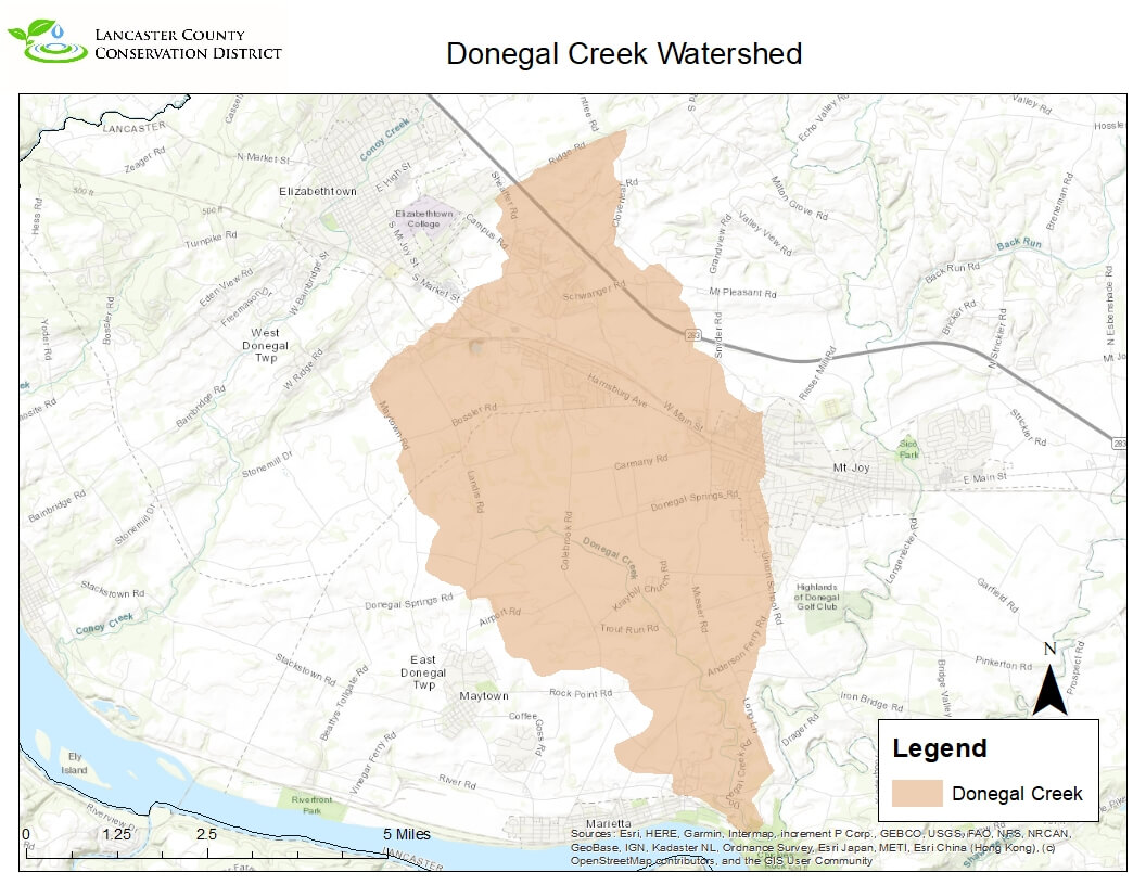
East Donegal Township, Mt Joy Borough, Mt Joy Township and West Donegal Township
Monitoring Data
No data available for this watershed area. Monitoring data is provided by community volunteers dedicated to improving our waterways. Contact us using the form below if you’re interested in learning more about becoming a volunteer watershed monitor. Your questions about Lancaster Watersheds are welcome.
Documents
Donegal Creek Planning Booklet PDF
The Donegal Creek Watershed is located in the Northwest section of the county. This is a 17 square mile watershed. Today there are about 28 miles of streams within the Donegal Creek Watershed. The mainstem of Donegal Creek and its tributaries flow mostly southeast to the stream’s confluence with the Chiques Creek just north of Chiques Rock. According to the USGS Stream Stats website only about 3% of the watershed is forested and nearly 6% of the watershed has urban development on it. The watershed starts east of Elizabethtown but does not flow through many cities or towns. There is an active watershed association doing work within the watershed, the Donegal Fish & Conservation Association. The Association does mostly outreach and educational work along with stream and conservation work throughout the watershed. There have been a couple of studies completed by various groups on the watershed. From watershed wide assessments to Total Maximum Daily Load Plans.


