East Branch Octoraro Creek
East Branch Octoraro Watershed Association Meetings
Contact Information
PO Box 75
Cochranville, PA 19330
(484) 947-9390
Email: octorarowa@gmail.com
Downstream Flow: VIEW GOOGLE MAP
East Branch Octoraro Creek » Octoraro Creek » Susquehanna River » Chesapeake Bay
Contributing Municipalities
Bart Township, Christiana Borough, Colerain Township and Sadsbury Township
Monitoring Data
Volunteer Monitoring Data Microsoft Excel Online
Sampling Sites: 70-71, 73, 76-77
Documents
Watershed Conservation Plan PDF
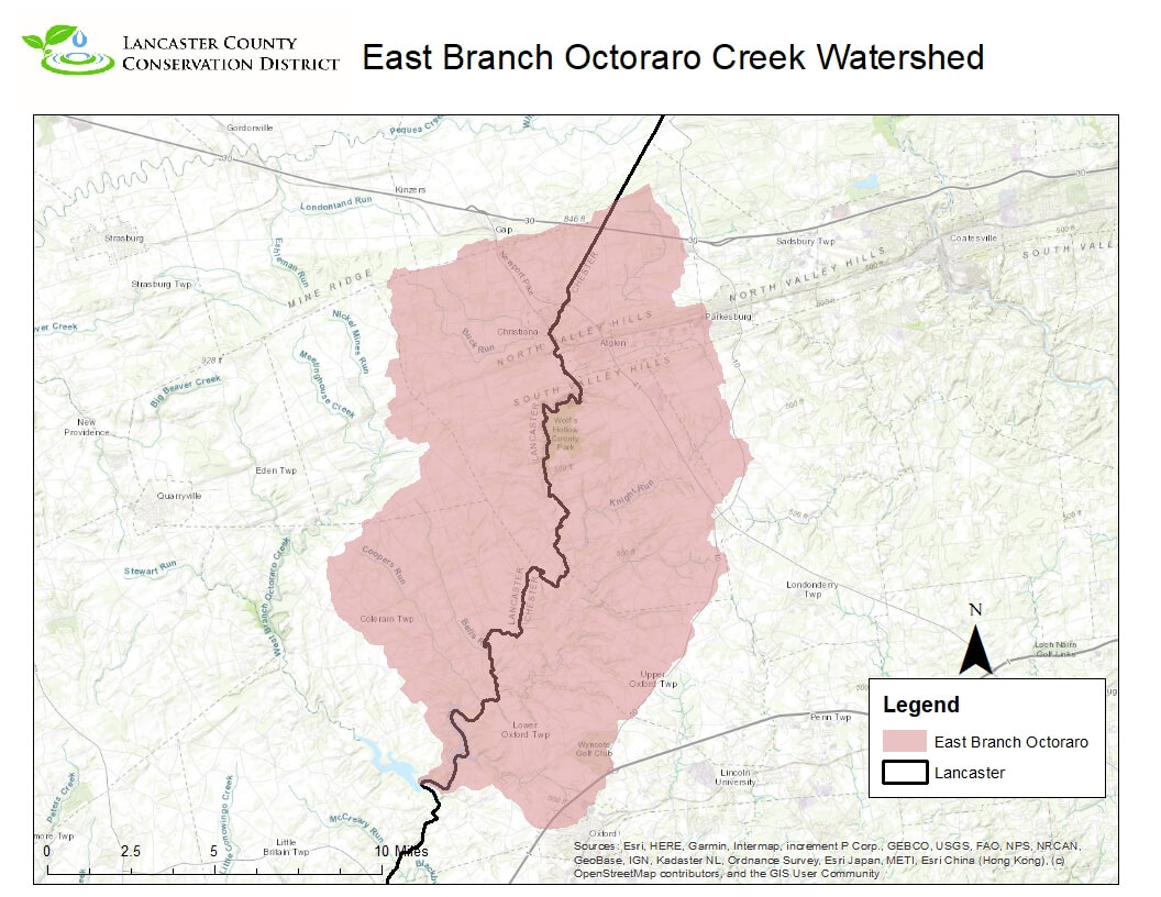
The Octoraro Creek Watershed is located in the Southeast section of the county and shares a county border with Chester county and goes into Maryland as well. This 210 square mile watershed was named by the Tuscarora Native American tribe, meaning “It is covered with water”. Today there are about 373 miles of streams in the Octoraro Creek Watershed. The West Branch of the Octoraro starts in Lancaster County while the East Branch starts on the Lancaster/Chester Border around Gap and Christiana. Both branches flow mostly south and confluence south of Kirkwood to form the Octoraro Reservoir. From the Reservoir the combined mainstem flows south into the state of Maryland to the stream’s confluence with the Susquehanna River. According to the USGS Stream Stats website about 26% of the watershed is forested and 2% of the watershed has urban development on it. The watershed is mostly rural in nature with very few towns or cities within the watershed at least in the Pennsylvania section. There is an active watershed association doing work within the watershed, the Octoraro Watershed Alliance. The Alliance has been around nearly 50 years and has done outreach and educational work within the watershed and also works with landowners and others on potential stream and streamside projects. There have been several studies completed by various groups within the watershed and outside the watershed as well. From watershed wide assessments to groundwater studies.


